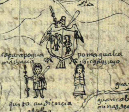
Detail, Mapa Mundi of the Indies of Peru, showing the quatripartite division of the Inka empire of Tawantinsuyu, from Felipe Guaman Poma de Ayala, The First New Chronicle and Good Government (or El primer nueva corónica y buen gobierno, c. 1615, p. 86 (image from The Royal Danish Library, Copenhagen)
Cite this page as: Beth Harris, "Detail, Mapa Mundi of the Indies of Peru, showing the quatripartite division of the Inka empire of Tawantinsuyu, from Felipe Guaman Poma de Ayala, The First New Chronicle and Good Government (or El primer nueva corónica y buen gobierno, c. 1615, p. 86 (image from The Royal Danish Library, Copenhagen)," in Smarthistory, May 22, 2016, accessed April 20, 2024, https://smarthistory.org/guaman-chronicle/mapdetail/.