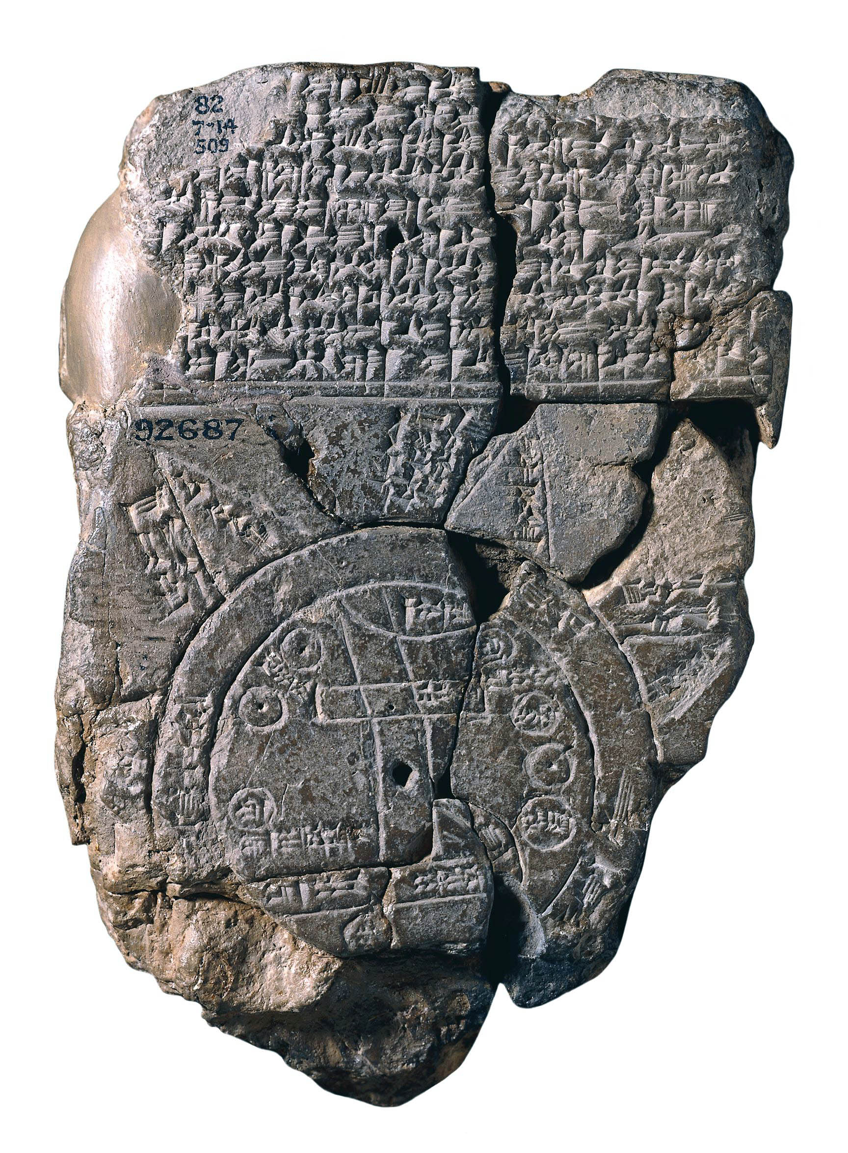
Map of the World, Late Babylonian, c. 6th century B.C.E., clay, findspot: Abu Habba (Sippar), Iraq, 12.2 x 8.c cm (© Trustees of the British Museum)
This tablet contains both a cuneiform inscription and a unique map of the Mesopotamian world. Babylon is shown in the centre (the rectangle in the top half of the circle), and Assyria, Elam, and other places are also named. The central area is ringed by a circular waterway labelled ‘Salt-Sea’. The outer rim of the sea is surrounded by what were probably originally eight regions, each indicated by a triangle, labelled ‘Region’ or ‘Island’, and marked with the distance in between. The cuneiform text describes these regions, and it seems that strange and mythical beasts as well as great heroes lived there, although the text is far from complete.
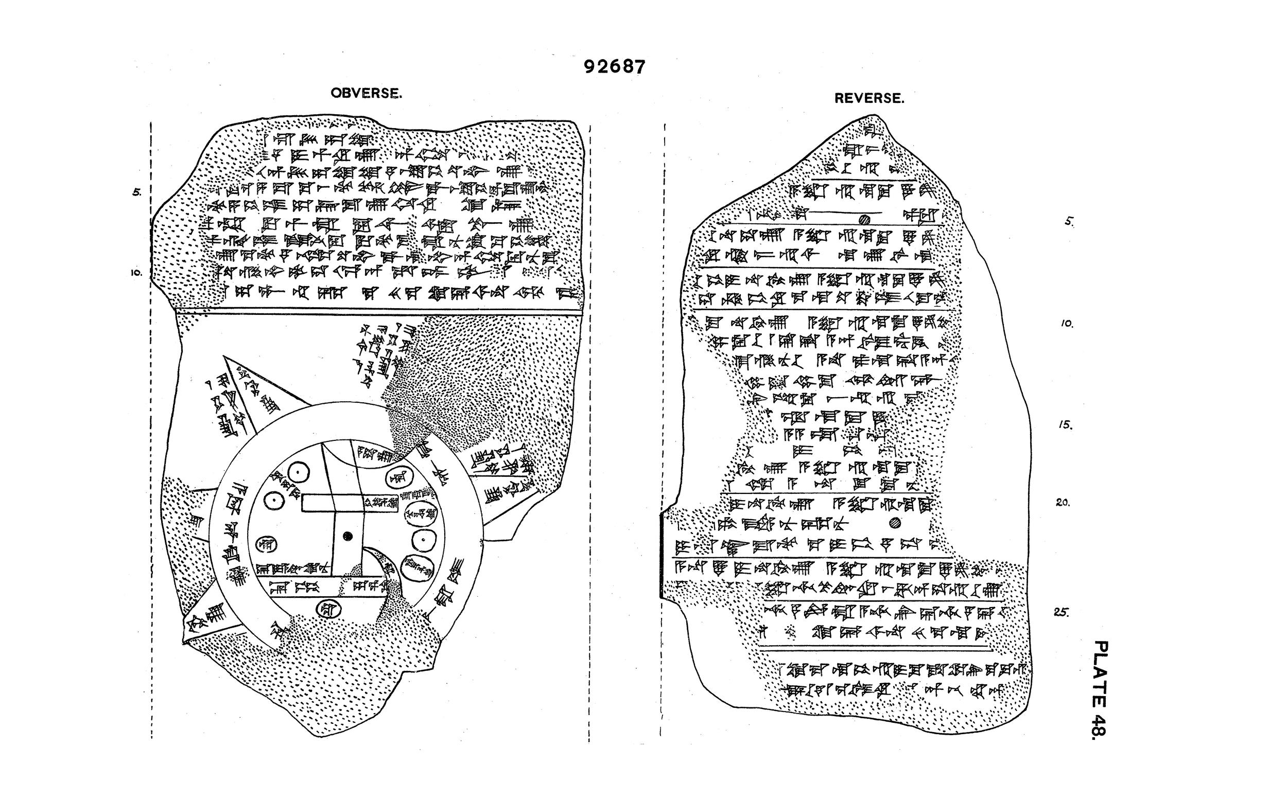
Line drawing of Map of the World, Late Babylonian, c. 6th century B.C.E., clay, findspot: Abu Habba (Sippar), Iraq, 12.2 x 8.c cm (© Trustees of the British Museum)
The regions are shown as triangles since that was how it was visualized that they first would look when approached by water.
The map is sometimes taken as a serious example of ancient geography, but although the places are shown in their approximately correct positions, the real purpose of the map is to explain the Babylonian view of the mythological world.
© Trustees of the British Museum